Aim and introduction
This is the third lesson in this series about the Wādī Darbāt and Kho Ruri and will explore the role the river and port had in Oman’s trade. Pupils will get a chance to use their gained knowledge on the river as well as exploring the physical geography of the area to help understand why this location was important for trade.
Curriculum links
human geography, including: types of settlement and land use, economic activity including trade links, and the distribution of natural resources including energy, food, minerals and water.
Use maps, atlases, globes and digital/computer mapping to locate countries and describe features studied.
Learning goals
- Understand the term ‘trade’.
- Know why Oman was important for trade.
- Understand how the Wādī Darbāt and Khor Ruri played a role in trade in Oman.
Learning outcomes
Greater depth: pupils will be able to define the term ‘trade’ using their own knowledge and the prompts from the images. They will be able to give examples of trade. Pupils will confidently identify many reasons why Oman was a great place for trading applying their own knowledge and understanding. They will be able to clearly interpret different maps to identify features which would have helped aid trade in specific regions in Oman.
Expected level: pupils will be able to define the term ‘trade’ using their own knowledge and/or the prompts from the images. Pupils will confidently identify reasons why Oman was a great place for trading using their own knowledge and understanding and/or prompts from the board. They will be able to interpret different maps to identify features which would have helped aid trade in specific regions in Oman there may be some inaccuracies in this.
Working towards: pupils will be able to define the term ‘trade’ using their own knowledge or the prompts from the images. Pupils will be able to identify reasons why Oman was a great place for trading using their own knowledge and understanding or prompts from the board. With some guidance, they will be able to interpret a map and identify features which would have helped aid trade in Oman, these might not be specific to a particular region.
Support: pupils will be able to define the term ‘trade’ using the prompts from the images. Pupils will be able to identify some reasons why Oman was a great place for trading using prompts from the board. With support, they will be able to interpret a map and identify features which would have helped aid trade in Oman, these will most likely be for the country / region in general rather than specific places.Key terms
- Trade
- Location
- Connections
- Materials
- Communities
- Supplies
- Routes
Learning resources
- Teacher Presentation – Lesson 3: Trade
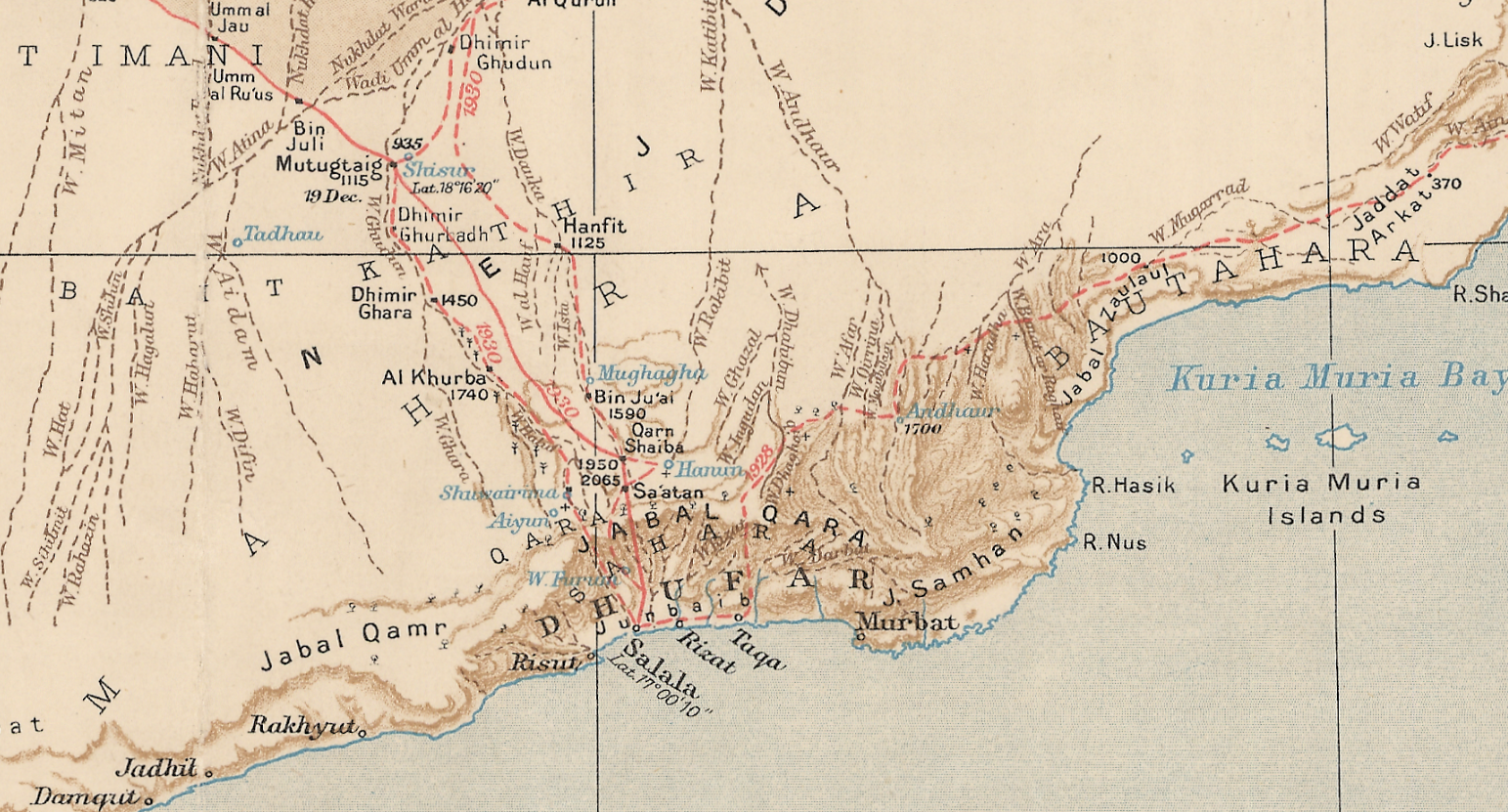
- Map of the South Arabian Desert by Thomas Bertram (1926 – 1931) and / or a GIS map of Oman.
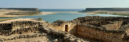
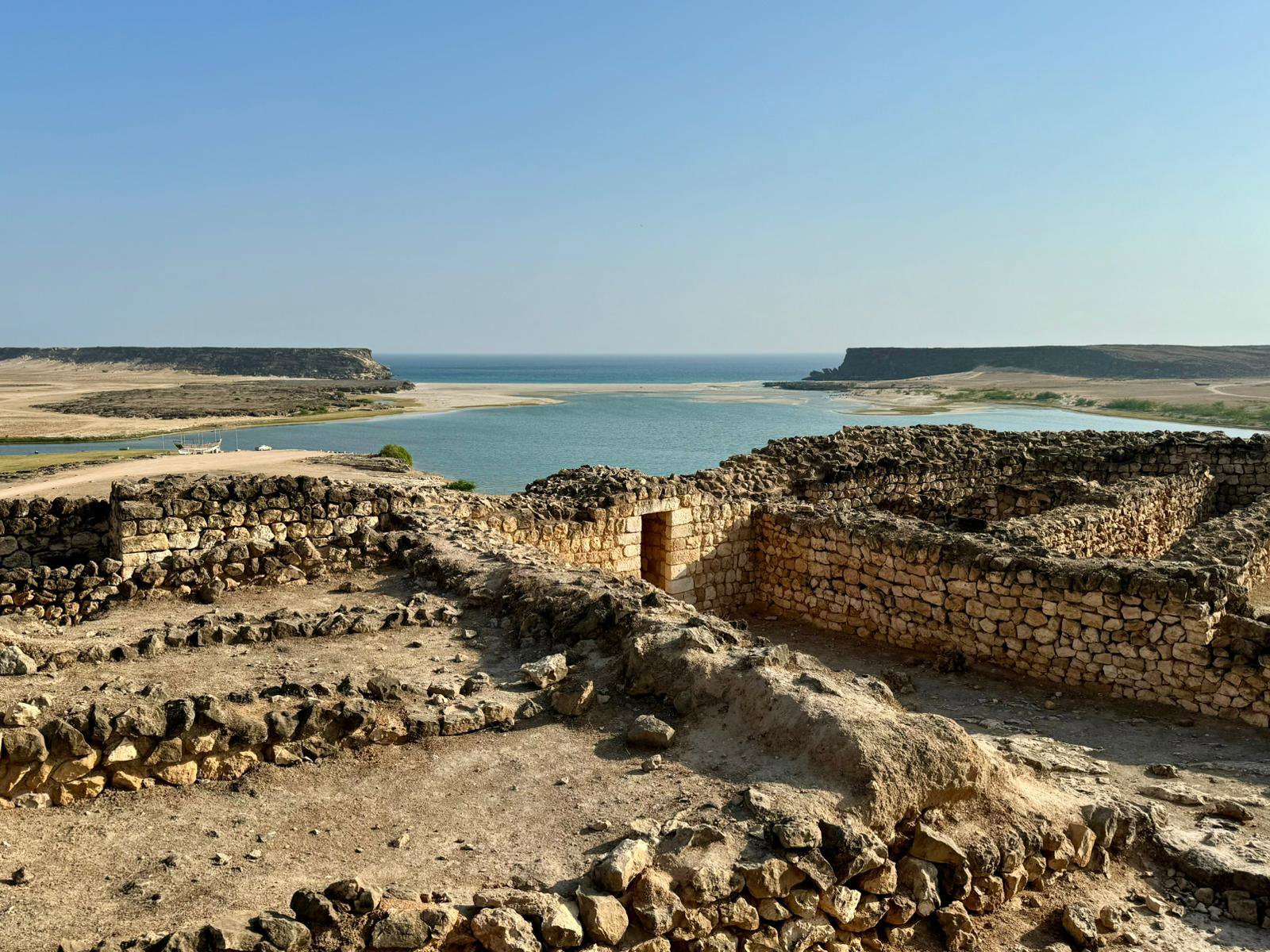
- Image of the Khor Ruri lagoon from Lesson 1.
- Card Sort
What you will need
- Exit card materials i.e. post its (if needed)
Challenge and support
Challenge pupils to identify other features on the map which haven’t been covered in the presentation and get them to explain why these might have been important for trade. Get them to use the key on the 1920s Map to see if they can see certain features which might have made trade routes happen in certain regions (i.e. the tree symbols in the Dhofar region indicating frankincense).
Support pupils by talking through the key features of the map to help them interpret them.
Starter
Teacher shows a series of images on the board showing trade. Pupils think-pair-share their understanding of the term while the teacher notes these down on the board. Teacher highlights the main aspects of trade to help the class understand the term.
Main
Reflecting on the starter, teacher provides a short background on why Oman was a great place for trade. A summary has been added to the PowerPoint (Slide 3). More detailed information can be found here if needed. Pupils then use the ones on the board as well as the additional facts as a card sort activity.
Pupils then look at the 1930s and/or a GIS map of Oman and identify the features discussed that made Oman important for trade. They could develop this, if time allows and annotate the maps summarising some of the most important facts they found out.
Plenary
Take a closer look at the area which has the Wādī Darbāt and Khor Ruri in. Pupils should use what they already know as well as the maps to help show why these places / features would have been important for trade. If it is helpful, project the image of the lagoon at Khor Ruri from Lesson 1 as additional information.
Sum up the lesson with an exit card activity to reflect on why Oman’s geography was important for trade.
File nameFiles
File type
Size
Download