Aims and Objectives
These activities should provide students with a good idea of what GIS is and how it is applied in the real world.
Students will be provided with a sound knowledge of the types of jobs available in this sector and the geographical skills needed to do those jobs.
Activities can be selected to be combined to provide a full lesson of material or integrated separately within lessons to fully embed careers education into your curriculum.
Key questions
- What is GIS?
- What skills do geographers have that are used in GIS careers?
- What jobs are available in GIS?
- How does GIS get used in the ‘real world’?
What is GIS?
A geographic information system (GIS) is a system that creates, manages, analyzes, and maps all types of data. GIS connects data to a map, integrating location data (where things are) with all types of descriptive information (what things are like there). This provides a foundation for mapping and analysis that is used in science and almost every industry. GIS helps users understand patterns, relationships, and geographic context. The benefits include improved communication and efficiency as well as better management and decision making (Source: Esri)
Organisations across the globe are increasingly relying on location intelligence to make better decisions. As a result, careers in GIS are in demand more than ever. Equipped with data visualization and spatial analysis skills, GIS professionals qualify for occupations in countless fields (Source: Esri)
For full information about what is GIS and how it is used, go to the Esri website
The RGS-IBG website provides a good overview of skills and careers within this sector
Example jobs in this sector
Analyst, Defence Geographic Centre
Crime and Disorder Advisor, MAPCITE
Data Collector, Ordnance Survey
Geographic Information Analyst, Metropolitan Police
GIS Analyst, Animal Health and Veterinary Laboratories Agency
Hydrologist, WS Atkins
Hydrometry and Telemetry Officer, Environment Agency
Land Requirements Geospatial Officer, Ministry of Defence
Training and Education Services Manager, Esri UK
Lead Specialist Advisor for Geospatial
Project Manager, Mapping Scotland’s Paths
Geospatial Consultant, Arup
GIS Analyst, Forestry Commission
Assistant GIS Consultant, WSP
Data analyst, HS2
Geospatial Information Specialist, Ministry of Defense
GIS Manager, Local Council
Senior GIS Analyst - Offshore Wind
Flood Risk and GIS Analyst
Head of Business Intelligence and Spatial Data Science
Cartographer
Land surveyor
Geospatial Technician
Activity: I am a Geographer
Exploring the types of jobs GIS specialists do and the pathways they follow to get those jobs

Activity: Job adverts and salary bands
Information to support activities focused on the skills needed to work in GIS and how GIS is used in the ‘real world'

Activity: GIS in practice – Ordnance Survey
Examples of how Ordnance Survey use data and GIS in the real world

Activity: GIS in practice – Esri
Profiles of professionals that work in GIS and details of their career pathways

Activity: Geovisualisation
Discover how geographers bring a unique perspective to presenting data in innovative and understandable ways.
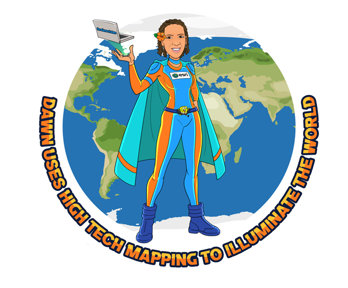
Activity: Geography superheroes
Introduction to Dawn Wright, a geographer, oceanographer and Chief Scientist of Esri who maps ocean floor
Unlocking the power of location: The UK’s geospatial strategy
This policy paper provides nine location data opportunities that could be linked to the curriculum.

Other sources of GIS careers information
Supporting information from the RGS-IBG and other organisations
File nameFiles
File type
Size
Download
