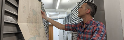
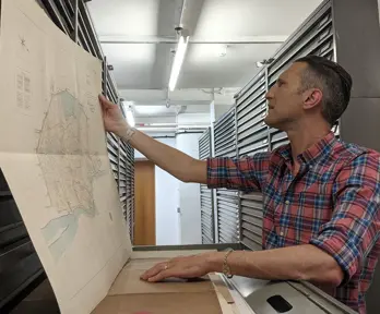
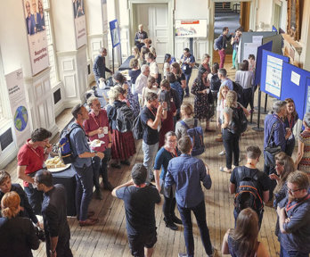
Chair's map room conversations
As part of a unique initiative at this year's conference, the Foyle Reading Room will host a series of conversations relating to the Society's map collection.
As part of a unique initiative at this year's Annual Conference, the Foyle Reading Room will host a series of map conversations between scholars.
Each conversation will feature two experts brought together by a common theme. They will briefly present a selection of maps curated from the Society's cartographic holdings, which comprise one of the largest private map collections in the world. The speakers and attendees will then engage in a close reading of the maps, seeking convergences, divergences, and points of interest.
The map room conversations have been convened by Professor Stephen Legg, Chair of Conference, around the conference theme of mapping.
Full details of each of the Chair's map room conversations are available in the conference programme.
The conversations will take place in the Society's Foyle Reading Room.
Mapping indigeneity
Indigenous scholars, communities, and campaigners have revolutionised cartography, studying Indigenous forms of mapping, Indigenous traces and absences in colonial maps, and the production of Indigenous counter-maps to contest state-based land claims. This conversation will explore the possibility of mapping Indigeneity using the Society's inherently imperial and acquisitive map collection.
Speakers:
- Arctic encounters: Dr Peter Martin (University of Nottingham)
- Silences, erasure, and agency: Dr Katie Parker (RGS-IBG)
Mapping language
Maps constitute their own language, allowing the world to be visually read as a text. But maps have also represented language directly. This conversation looks at how maps name places, and how they identify places where languages are spoken.
Speakers:
- Mapping names: Beth Williamson (Royal Holloway, University of London)
- Mapping speakers: Dr Philip Jagessar (King's College London)
Mapping objects
Maps are images but they are also things, most often folded and carried. But maps also have other important object relations. They are the product of tools in the field, that survey and encode the land. They also produce objects that are heftier than a paper print. This conversation will contrast the tools of map production with plaster relief models which pre-date today’s 3D maps by 70 years.
Speakers:
- Construction and outcomes: Jane Wess (University of Edinburgh)
- Relief models: George Tobin (University of Glasgow)
Mapping race and internationalism
The art of mapping has been widely connected with the politics of nationalism and imperialism. This conversation explores maps and internationalism, and racial politics from the interwar years, through mappings of the League of Nations and its mandate of Palestine.
Speakers:
- The League of Nations: Dr Jake Hodder (University of Nottingham)
- Palestine: Zena Agha (Newcastle University)
Mapping art
For generations of geographers, and the general public, maps are transfixing things of beauty. But maps have also inspired generations of artists to reformulate the very concept of the map, and to use maps to inspire new forms of art. The conversation brings together two artists who have used the RGS-IBG map collection pieces in their recent works at the Society.
The conversation will conclude with a visit to the Map Room, where Hormazd will introduce his artwork, Expanding Universe, inspired by the maps in the Society's collection. The artwork is on long-term loan to the Society.
Speakers:
- Expanding universe: Hormazd Narielwalla (Independent artist)
- Mapping Earth: Lorraine Rutt (Crafts Council)
Mapping expeditions
Maps are scientific instruments but also memory devices, reminding us of distant homes or places once visited. For diasporas they can be objects of connection and education. This conversation connects two scholars who have used RGS-IBG maps in work with South Asian communities in the UK who have connections to north-west India/Pakistan and north-east India/Nepal.
Speakers:
- The Karakoram survey: Dr Jonathan Westaway (University of Central Lancashire)
- Antarctic science: Alice Oates (University of Cambridge)
Maps and diasporic communities
Behind the historical production of maps lie physical movements through space. Whether framed through imperial fantasies of exploration and consolidation, or quests for scientific truth, such expeditions were engines of personal and cartographic anxiety. This conversation brings into dialogue maps from expeditions towards northern India and the southern pole.
Speakers:
- The Hindi-Urdu Belt: Iqbal Singh (National Archives)
- Himalayan Indigeneity: Dr Rohini Rai (Brunel University)
Programme
The conference programme will be published in May 2025.
Chair's plenary conversations
Find out about the plenary conversations, all convened around the theme of Geographies of creativity/creative geographies.
Chair's map room conversations
Find out more about the map room conversations, a new initiative at this year's conference.
Pre-conference activities
Find out more about activities taking place in the run-up to the conference.