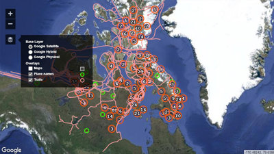
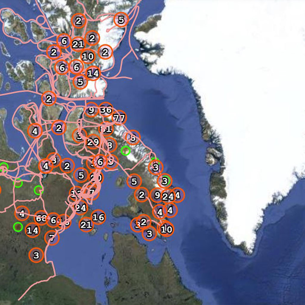
This image is a screenshot of a digital map, part of the Pan-Inuit Trails Atlas, an online education resource. The atlas uses historical maps, both printed and in manuscript, to show the trails and places used by Inuit peoples in the 19th and 20th centuries.
Not only are these trails and place names important parts of Inuit culture and heritage; they also can help with Inuit sovereignty claims as the Arctic increases in geopolitical prominence.
The atlas is one part of the The Northwest Passage and the construction of Inuit pan-Arctic identities project funded by the Canadian Social Sciences and Humanities Research Council (SSHRC) and co-directed by Michael Bravo (University of Cambridge), Claudio Aporta (Dalhousie University) and Fraser Taylor (Carleton University). It focuses on the Eastern and Central Canadian Arctic but will hopefully expand its scope in the future.
To make the atlas, historical maps were georeferenced and layered to a base map.
What's on the atlas?
Users can see the larger spatial coherence of Inuit peoples by looking at the base map, where lines represent trails and circles represent place names. When zoomed in and/or when some of the layers are activated, users can learn more about the content and extent of the original documents.
The trails and place names shown in the atlas emphasise the network of routes used by Inuit peoples since time immemorial. In everyday use, this geographical knowledge is accessed orally, linking Inuit peoples across the Arctic.
However, as the Arctic features more prominently in discussions of geopolitics, and as more money is invested in resource extraction in the region, creating a visual resource like this is one way to prove historical occupancy and sovereignty by Inuit peoples over the territories and waterways of the Northwest Passage.
Further readings
Bravo, Michael. North Pole: Nature and Culture. London: Reaktion Press, 2019.
Martin, Peter R. ‘The “deer-men” and the “bowhead-men”: the colonial co-optation of Arctic Indigenous knowledge within the “origins of the Inuit” debates.' Transactions of the Institute of British Geographers 49, no. 1 (2024): e12615.
Martin, Peter R. ‘"Kalli in the ship": Inughuit abduction and the shaping of Arctic knowledge.' History and Anthropology (2023): 1-26.
Martin, Peter R. ‘The Cartography of Kallihirua?: reassessing Indigenous mapmaking and Arctic encounters.’ Cartographica: the International Journal for Geographic Information and Geovisualization. 57, no. 3 (2022): 239-255.