Indigenous mapping and colonial collecting in Burma (Myanmar)
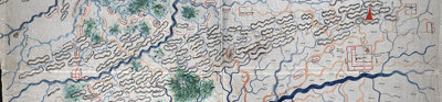
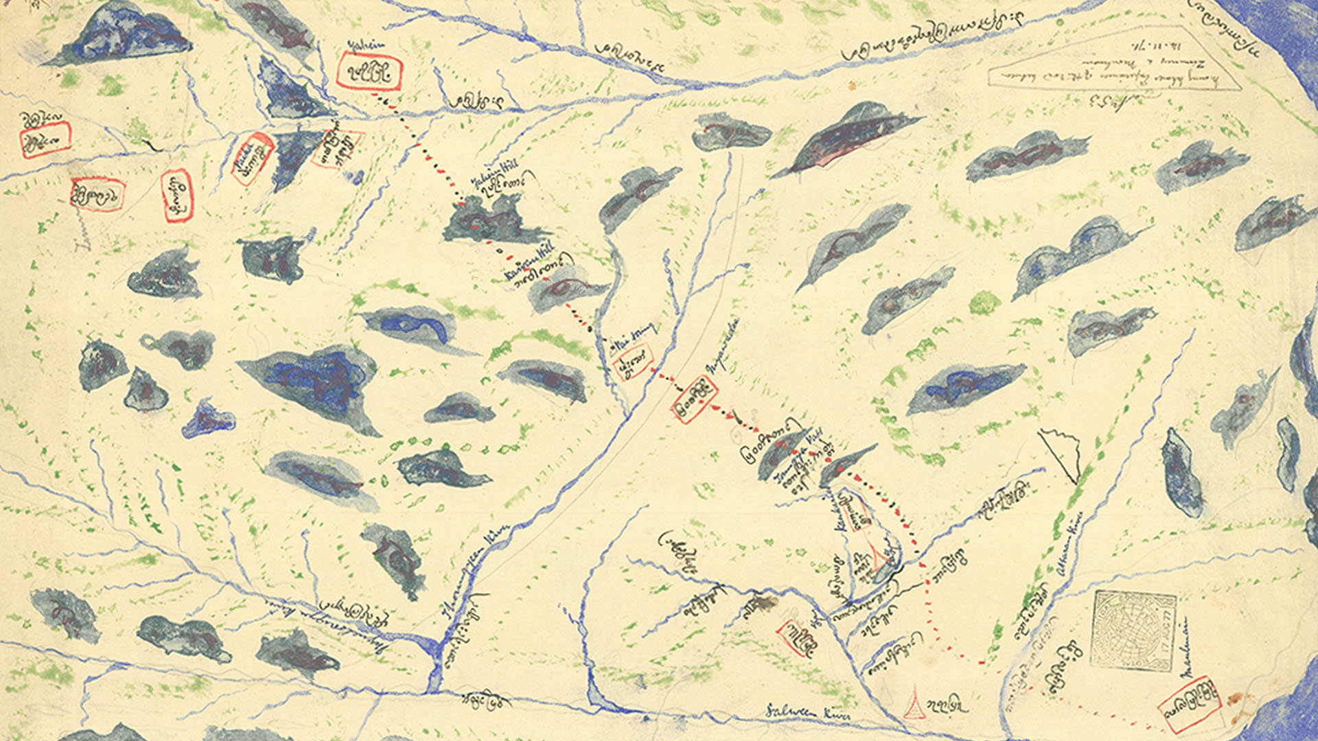
These maps are two of a collection of 29 manuscript maps made by Indigenous peoples or based upon local knowledge of trade routes and geography in what is today the border region between Myanmar and Thailand.
They depict the area between the port city and early colonial capital of Moulmein and Zimmay (Chiang Mai). Both maps were made by Burmese individuals, likely traders, whose geographic knowledge was of interest to the colonial judge John Coryton.
Coryton, a lawyer who served as the Recorder of Rangoon and Moulmein, compiled a collection of Burmese maps by asking traders to draw their travel routes, gathering documents that came to the court of Moulmein, and through British colonial contacts. His interest stemmed from his desire to develop and promote his plans for a trade route from Burma to western China, as argued in a paper he gave at the Society in March 1875, the same year he donated the maps to the Society.
Maps as artefacts of colonial-era collections
The maps are important examples of Indigenous geographical practices and of European dependence on local knowledge. They also underscore the role that imperial networks play in the creation and organisation of major research collections like that of the Society.
As Joy Slappnig argues in her PhD thesis on Indigenous maps in the Society collections, these maps can be read as ‘material embodiments of colonial encounters and also as traces of the agency of indigenous peoples involved in their creation, making them significant artefacts in colonial-era map collections.’
Slappnig’s thesis provides case studies of several maps of Southern Asia that were made by Indigenous peoples and whose appearance and meanings altered as they were copied, circulated, or collected within Western imperial contexts.
The thesis, completed jointly with the Society and Royal Holloway, University of London, is one of several doctoral dissertations the Society has supported with funding from the Arts and Humanities Research Council. Such research, and the research of the hundreds of scholars who access the Society’s library and archives each year, allow a continual reassessment of the potential of the Collections to tell stories about a wider variety of audiences and to better serve diverse communities.
Further readings
Slappnig, Joy. ‘The Indigenous map: native information, ethnographic object, artefact of encounter.’ PhD diss., Royal Holloway, University of London, 2022.
De Rugy, Marie. Imperial Borderlands. Maps and Territory-Building in the Northern Indochinese Peninsula (1885-1914). Leiden: Brill, 2021.
Rose-Redwood, Reuben, Natchee Blu Barnd, Annita Hetoevėhotohke’e Lucchesi, Sharon Dias, and Wil Patrick, guest editors. ‘Special Issue: Decolonizing the Map.’ Cartographica 55, no. 3 (2020).